

Flying drones to inspect a farm, construction site, or any other venue from overhead can generate a huge amount of data. It takes time, though, for drone users to upload and turn this high-resolution data into maps, graphs or business intelligence they can act upon.
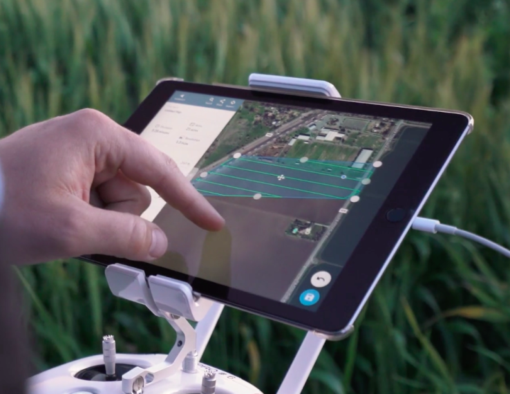
Today, a data management platform for drones called DroneDeploy, is launching a tool called Fieldscanner that makes it possible to draw a low-resolution satellite map in real time with a drone, in the field, even where there’s no internet connectivity. Being able to see the map draw out as you’re flying means you can change course, or take multiple passes over a problem area before you land.
According to DroneDeploy co-founder Jono Millin, here’s how it works:
“You take your drone out, plug your phone into a remote control using the DroneDeploy app. In our flight-planning interface, there’s a Fieldscanner toggle, which you can turn on from the start. Then you press “go,” and begin flying as you normally would. You can view your Fieldscan offline. You don’t have to connect and upload your data to the cloud. You can…